Exact knowledge of the current ground-water levels, and hence also of groundwater stocks, is imperative for the State of Berlin, since 100% of the drinking-water supply (approx. 205 million cu.m. in 2008) is obtained from groundwater. This groundwater is pumped at nine waterworks, almost entirely within the territory of the city. Only the Stolpe Waterworks on the northern outskirts obtains water from Brandenburg, but also supplies Berlin with approx. 9 % of the city’s total intake (Fig. 1).
New
The Environmental Atlas maps are available in the new Map Application
Groundwater Levels of the Main Aquifer and Panke Valley Aquifer 2009
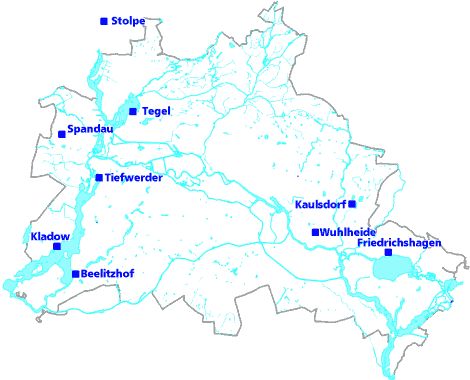
Fig. 1: Location of the nine waterworks which supply Berlin with drinking water, as of May 2009
Image: Umweltatlas Berlin
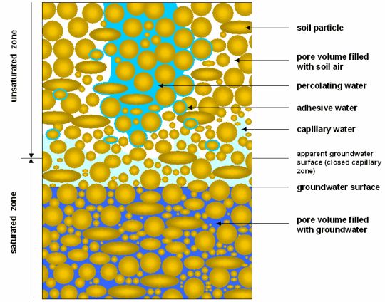
Fig. 2: Phenomenology of Underground Water
Image: from Hölting 1996
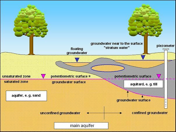
Fig. 3: Hydrogeological Terms
Image: Umweltatlas Berlin
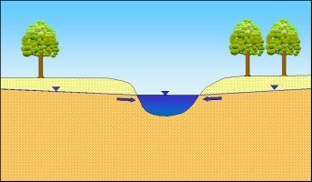
Fig. 4a: Groundwater infiltrates into bodies of water
Image: Umweltatlas Berlin
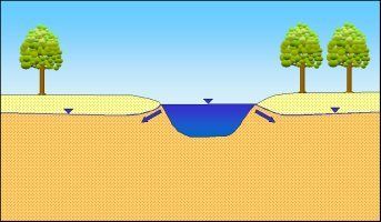
Fig. 4b: Bank-filtered water caused by flood water: surface water infiltrates into groundwater
Image: Umweltatlas Berlin
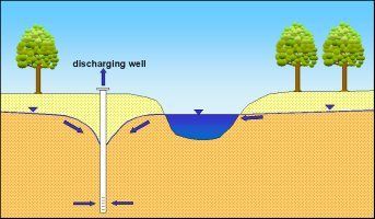
Fig. 4c: Bank-filtered water caused by discharge of groundwater: due to the drop in the groundwater caused by wells, surface water infiltrates into the groundwater
Image: Umweltatlas Berlin
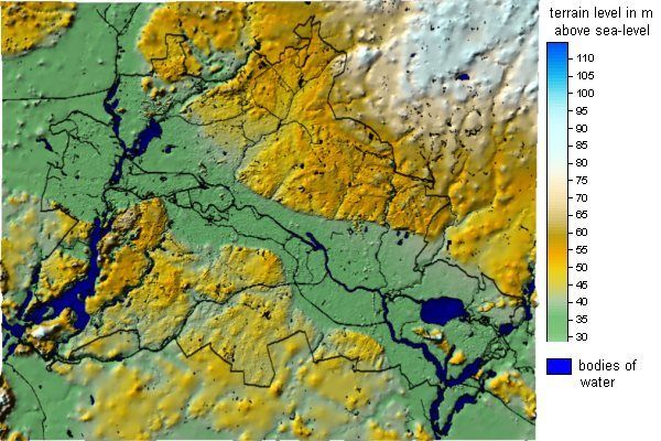
Fig. 5: Morphological Outline Map of Berlin
Image: Umweltatlas Berlin
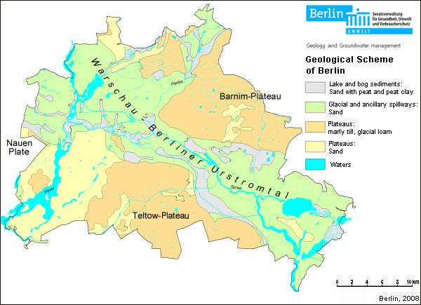
Fig. 6: Geological Outline Map of Berlin
Image: Umweltatlas Berlin
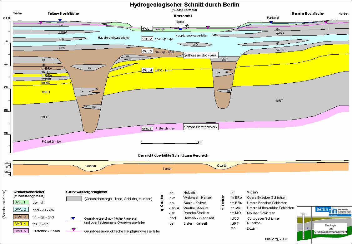
Fig. 7: Schematical Hydrogeological Cross-Section of Berlin from South to North
Image: from Limberg, 2007
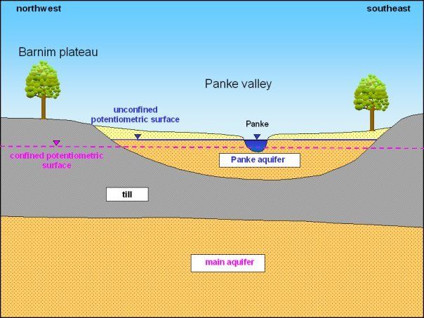
Fig. 8: The unconfined Panke Valley aquifer (Aquifer 1) in the northwestern area of the Barnim Plateau is situated above the main aquifer (Aquifer 2), which is confined in this area
Image: Umweltatlas Berlin
Environmental Atlas Contact
Berlin Senate Department for Urban Development, Building and Housing
Mrs. Haag