Moreover, in construction, the MHGL can also be used for geostatical calculations in certain cases and may be relevant for other issues of water management and ecology.
The mean highest groundwater level (MHGL) is defined as the mean value of the annual maximum values of the observed groundwater level.
The MHGL is calculated using groundwater levels recorded at groundwater measuring points. In order to obtain statistically reliable values, the groundwater hydrographs should be based on a measuring frequency as high as possible. If the MHGL is required for a location where no or no suitable groundwater measuring point is available, the MHGL can be interpolated from the values of neighbouring measuring points. In both cases, the mean highest groundwater level is a value that is determined from groundwater levels observed in the past.
In practice, the MHGL is mostly needed for questions directed towards the future. Accordingly, it is only meaningful if the groundwater level can be assumed to behave similarly in the future as in the past. However, this is not the case in large parts of the Berlin city area since the groundwater level has been artificially changed, sometimes permanently, sometimes temporarily.
The permanent measures, which modified the natural geohydraulic conditions to locally different extents in the past and also began at different times, include:
- rainwater sewerage, which may have the effect of reducing new groundwater formation and thus lowering the groundwater level;
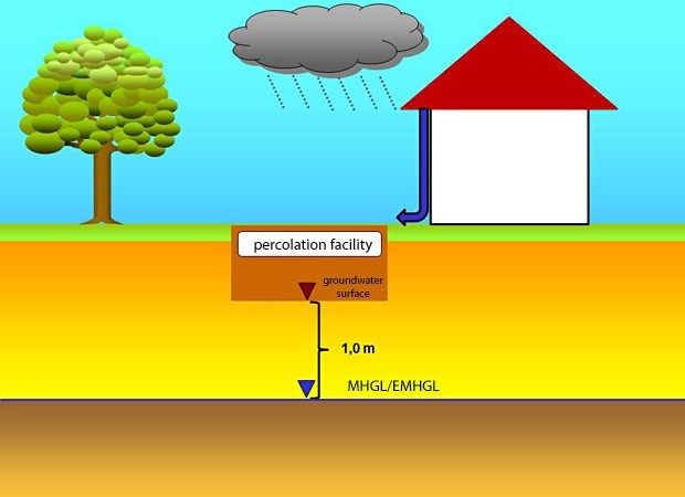
- decentralised rainwater disposal in percolation facilities, which may locally raise the groundwater surface, depending on the precipitation events;
- drainages and ditches that were intentionally used to lower the groundwater level locally;
- hydrological construction measures (impoundments, shore revetments, straightening of watercourses), which may lead both to a rise and to a drop in the groundwater level;
- structures protruding into the groundwater, with the effect of groundwater afflux in the direction of inflow and lowering in the direction of outflow.
The temporary measures and those that may vary considerably in duration include:
- groundwater extractions for the public and private water supply and for keeping water out of construction pits or for remediation, which lower the groundwater surface;
- groundwater replenishments for increasing groundwater availability for the public water supply, which raise the groundwater level in the vicinity of the replenishment facilities;
- reinfiltration of extracted groundwater, e.g. in the context of groundwater preservation measures for construction purposes, which also raise the groundwater surface – usually only locally.
This multitude of possible artificial measures that affect the groundwater illustrates that in some cases it is difficult even for specialists to judge whether and to what extent observed annual maximum groundwater levels from which the MHGL is calculated are anthropogenically influenced and thus to what extent the MHGL can be assumed to be valid in the future. Another problem results from the fact that both the observation periods and the measuring frequencies of the individual groundwater measuring points often differ. On the one hand, there are measuring points which have already been observed for more than 140 years; on the other hand, some have only existed for a few years. The measuring frequency varies between daily measurements, as is the case today for most measuring points of the Senate, and bimonthly and less frequent measurements, which cannot record the actual history of the groundwater level and thus its maximum values as reliably. The MHGLs of the individual
measuring points are thus not directly comparable, which is, however, necessary, particularly for interpolation. In practice, the State Geological Service has therefore conducted a rather time-consuming assessment and selection of data for calculating the MHGL in each individual case. (Note: The earlier specification of the 90th percentile value of the groundwater level data of a measuring point for determining a design value for percolation facilities corresponds approximately to the mean highest groundwater level.)
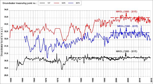
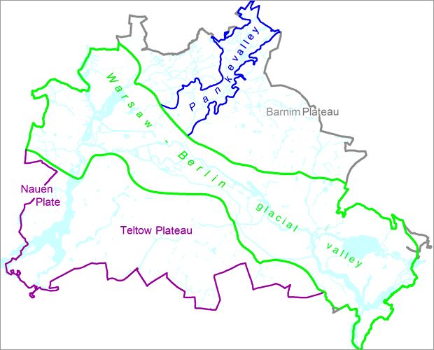
Figure 2 shows three examples of groundwater hydrographs with MHGL values in the Berlin glacial valley: The groundwater measuring points 5476 and 8979 show strong influences from groundwater extractions up to the 1990s; the end of the influence cannot be determined exactly but has to be specified by the specialist in order for the mean highest groundwater level to be calculated. Measuring point 137 has a significantly longer history without influence, from around 1980 on but also in the period from 1965 to 1975. It only makes sense to use the data from the periods without influence for determining an MHGL which is to be used e.g. for planning a percolation facility.


