Flood Areas 2018

Map Description

The map of flood areas defined for the State of Berlin shows the location of the five flood areas as stipulated on 23 October 2018 (GVBl. 27 November 2018):

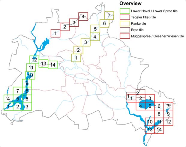
The protective provisions of Section 78 WHG shall apply upon the determination of the flood areas. They include structural restrictions, use restrictions and water protection. The provisions of the individual ordinances, which determine the flood areas, supplement and in part mitigate these protective provisions. Depending on the size of the area, each ordinance includes between 2 to 14 maps. The maps show the area and boundaries of the defined flood areas at a scale of 1 : 2,500. Figure 2 shows an overview of the individual map sheets (tiles).

Fig. 2: Overview of map sheets (tiles) for each flood area

Fig. 2: Overview of map sheets (tiles) for each flood area

In the flood area map, the outer edges of a hatched area determine the boundaries of the respective flood area. The body of water itself including its shores are not part of the flood area. The maps also display the contour lines of the water levels for the flood areas Lower Havel / Lower Spree and Müggelspree / Gosener Wiesen. The Lower Havel / Lower Spree flood area is divided into flood areas Lower Havel I and Lower Havel II, in order to standardize specific exceptions to use restriction based on hydraulic conditions.

The five flood areas of Berlin cover a total area of 6.8 km² and account for almost 0.8 % of the total city area (see Table 2).

Tab. 2: Size of defined flood areas

  • Flood area

    Size [km²]

  • Müggelspree and Gosener Wiesen

    2.6

  • Lower Havel / Lower Spree

    2.2

  • Erpe

    0.5

  • Panke

    0.5

  • Tegeler Fließ

    1.0

  • Total

    6.8