Watercourses
Due to the urbanised character of large areas of the federal state of Berlin, the morphology of Berlin’s watercourses is mostly strongly to totally modified (see Table 2).
The Environmental Atlas maps are available in the new Map Application
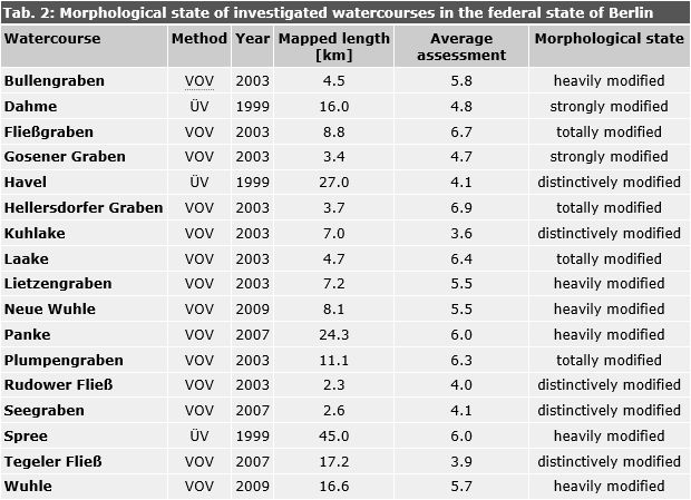
Tab. 2: Morphological state of investigated watercourses in the federal state of Berlin
Image: Umweltatlas Berlin
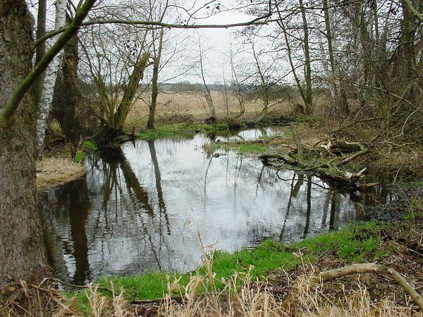
Fig. 1a: Tegeler Fließ, segment 85 near the district of Lübars characterised by a “marginally modified” morphology
Image: Umweltatlas Berlin
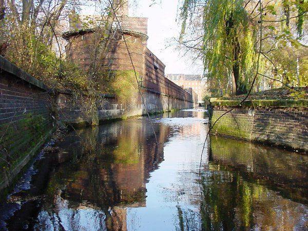
Fig. 1b: Panke, segment 22 in the district of Wedding (near Badstraße), characterised by a “totally modified” morphology
Image: Umweltatlas Berlin
![Tab. 3: Morphological state of the lake shores in the federal state of Berlin. The division into lakes, basins and sub-basins was adopted from the Gewässeratlas Berlin [SenStadt, 2002]](/imgscale4/ropen/umweltatlas/_assets/wasser/gewaesserstrukturguete/en-tabellen/et2061_03.gif)
Tab. 3: Morphological state of the lake shores in the federal state of Berlin. The division into lakes, basins and sub-basins was adopted from the Gewässeratlas Berlin [SenStadt, 2002]
Image: Umweltatlas Berlin
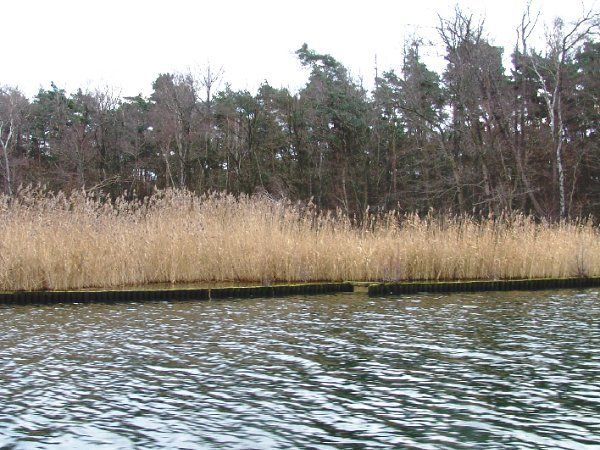
Fig. 2a: Seddinsee, “marginally modified” segment 98 located on the south-eastern shore
Image: Umweltatlas Berlin
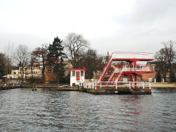
Fig. 2b: Müggelsee, “totally modified” segment 5 on the northern shore in the district of Friedrichshagen
Image: Umweltatlas Berlin
Berlin Senate Department for Urban Development, Building and Housing
Mrs. Haag