Surface and Terrain Models
- Image-based Digital Surface Model (iDSM, German: bDOM), aerial photography flights on August 1, 8, 12 and 16, 2020 (SenStadtWohn 2021d)
- Image-based Digital Surface Model (DSM, German: DOM), aerial photography flights in 2009/ 2010 (DLR 2013b)
- ATKIS DTM1 2021– Digital Terrain Model (German: DGM), aerial photography flights on February 24-25 and March 2, 2021 (SenStadtWohn 2021c)
Geo Base and Planning Data
In addition to the surface and terrain models mentioned above, the following vector data was available as statistical block and block segment areas as well as building and roadside tree data for the entire urban area of Berlin:- Official Real Estate Cadastre Information System (ALKIS), building and structure level, as of September 6, 2021 (SenStadtWohn 2021a)
- Berlin’s stock of trees (roadside trees and trees in parks/ recreational areas), as of May 11, 2021 (SenStadtWohn 2021b)
- Block (segment) area map 1 : 5,000 of the Urban and Environmental Information System (ISU5), as of December 31, 2020 (SenStadtWohn 2020a)
- Non-ALK buildings, as of May 2012 (DLR 2013b)
- Open Street Map building data, as of November 23, 2021 (OSM 2021)
- 3D building models in Level of Detail 2 (LoD 2), as of March 1, 2019 (SenStadtWohn 2019)
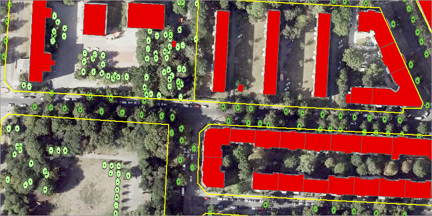
The ISU5 block (segment) area map constitutes the reference geometry for recording the objects to be identified and their heights. There are about 26,000 block (segment) areas in the urban area. The extracted objects are intersected with the block keys based on their unique object key, so that each individual object is not only associated with its exact location, but also its block (segment) area and borough number (cf. Figure 2).
Orthophotos
- Digital colour infrared true orthophotos (TrueDOP20CIR), aerial photography flights on August 1, 8, 12 and 16, 2020 (SenStadtWohn 2020)
- Digital colour infrared orthophotos (DOP20CIR), aerial photography flights on July 21 and August 21, 2010 (SenStadt 2011a)