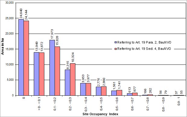
Ascertaining the Site Occupancy Index
The site occupancy index (SOI) states the built-up proportion of a lot. The SOI is a decimal number with one or two fractional digits.
Thus, the formula to calculate the SOI used to prepare the present map is derived as follows: the sum of all built-up areas on a lot – here, the block or block segment area – is divided by the total area.
Since the building areas do not correspond to the block area boundaries, only the proportions of those building areas that actually lie within the block area boundaries were summed. To achieve this, the building boundaries were intersected with the block areas of Block Map 1 : 5,000 (ISU5). Building parts located outside of block areas, e.g. on traffic areas (road surfaces), were not considered.
Ascertaining the Floor Space Index
The floor space index (FSI) indicates the number of square metres of floor area per square metre of lot area, here at block or block segment area.
For ascertaining the FSI, the following applies:
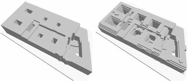
The sum of all floor spaces of the main buildings and building components (cf. Fig. 1) located on a block or block segment area is divided by the block size. The floor area of a building is thus calculated by summing the areas of all full storeys. (Generally, this means: number of full storeys multiplied by the floor area of the building).
Consideration of Structural Facilities as per Article 19, Para. 4, BauNVO in ascertaining the Site Occupancy Index (SOI)
BauNVO defines two different parameters to calculate the site occupancy index. They differ in whether ancillary structures are included in the calculation.
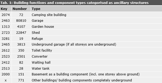
According to Article 19, Para. 4, BauNVO, garages and carports, including their driveways and ancillary and structural facilities, are part of the floor area (cf. Tab. 1).
As a first step in the calculation, the “main facilities” as per Article 19, Para. 2, BauNVO, were ascertained. As a second step, the floor areas of garages, carports, underground car parks and ancillary structures listed in the ALKIS were added. The buildings of the types shown in Table 1 were categorised as ancillary structures if they had less than two storeys. As per Article 14, BauNVO, ancillary structures are not considered in the determination of floor space.
In cases where above-ground and underground structures overlap, the above-ground structures were cut out of the underground structures (e.g. in the case of an underground car park in a building).
To determine the site occupancy indices (SOI) presented in the map, only the main facilities as per Article 19, Para. 2, BauNVO were ascertained, disregarding ancillary structures. The map therefore does not display values including ancillary structures, i.e. garages, sheds etc. (Article 19, Para. 4, BauNVO), but these numbers were determined and can be accessed through the factual data display.