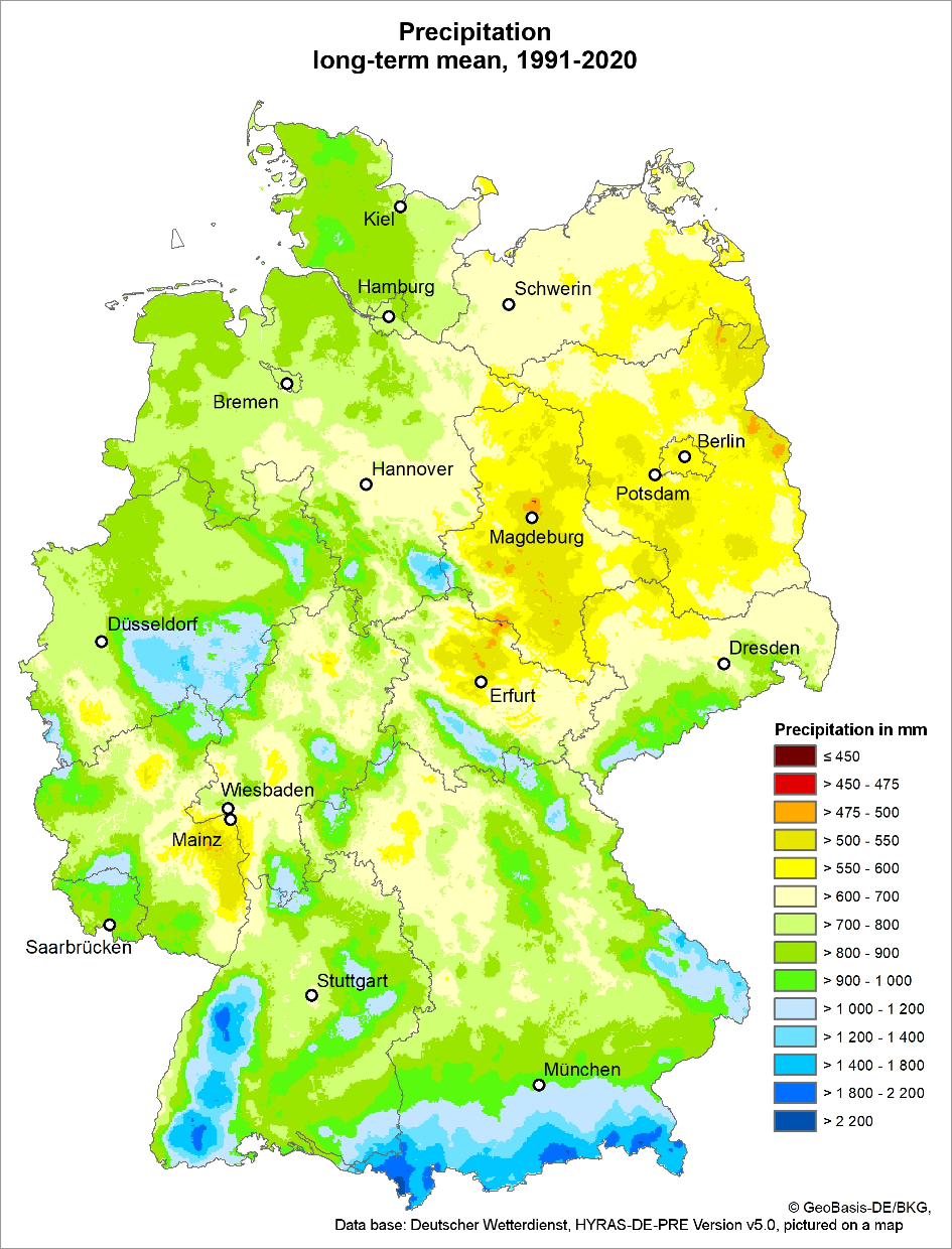
The mean precipitation distribution provides key information on the development of precipitation in an area. In individual events, however, the precipitation distribution may deviate greatly from the mean precipitation distribution. This applies in particular to heavy rainfalls, as they are usually confined to smaller areas and not evenly distributed (cf. Spektrum.de online 2016, only in German). They occur during the summer months as a result of convective air flows reinforcing themselves. Although physiographic characteristics may contribute to the development of heavy rain cells, their formation is highly coincidental.
Heavy rainfalls can thus contribute to small-scale changes in the annual or semi-annual means. Considering the long-term period of 30 years, however, the impact of individual events is rather insignificant, as heavy rainfalls are quite rare and random in their distribution.
The weather conditions in an area are greatly influenced by its topography (surface structure of the earth). Mountain ranges, smaller hill chains, and even lower ridges already have an impact on the amount of precipitation. Other influencing factors include forests, lakes, fields and such (cf. Flohn 1954, only in German). Furthermore, cities with their agglomerations of buildings influence the quantity and distribution of precipitation once they reach a certain size.
Increased precipitation within a confined area, due to, for example, relief rainfalls are mainly caused by the influence of soil friction, i.e. the surface roughness parameter. Soil friction slows down the lower air layers, causing subsequent air masses to accumulate and rise. Adiabatic cooling may effect the formation of clouds and precipitation. Additionally, aerosols tend to accumulate above urban areas more often. As condensation nuclei, they influence the formation of clouds and precipitation. In addition, the heat emanating from urban areas may contribute to convective precipitation, if additional constraints come into play.
The present evaluations are based on grid data provided by Germany’s Meteorological Service (DWD). The DWD’s REGNIE data was used to analyse the reference period between 1981 and 2010. This data set, however, has been discontinued and will no longer be updated. The current update was therefore based on the precipitation data of the HYRAS-DE-PRE data set. The DWD’s scientifically improved HYDRAS-DE-PRE data set succeeds and replaces REGNIE entirely.
As the data base changed, the Environmental Atlas’ results of the long-term mean precipitation distribution from 1981-2010 may only be compared to those of the current period to a limited extent.