The City of Berlin covers an area of 889 km². Of this, 55% is built up, and 45% is green and/or open space (cf. Fig. 1).
New
The Environmental Atlas maps are available in the new Map Application
Actual Use of Built-up Areas / Inventory of Green and Open Spaces 2000
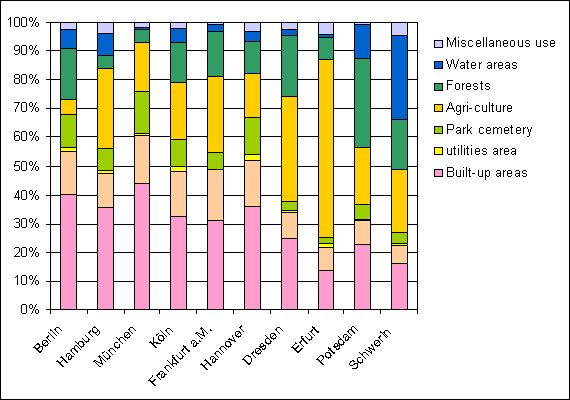
Fig. 1: Land Use in Berlin by Comparison with Other Cities
Image: according to the 1991 Statistisches Jahrbuch (Statistical Yearbook) of the City of Munich and the 1991 Statistisches Jahrbuch of the City of Berlin
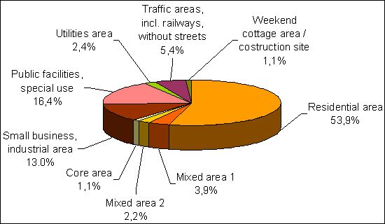
Fig. 2: Shares of the Various Use Categories of the Total Built-Up Area of Berlin
Image: Umweltatlas Berlin
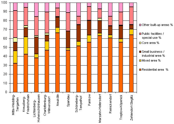
Fig. 3: Proportions of Selected Use Categories in the Built-Up Areas of All Berlin Boroughs
Image: Umweltatlas Berlin
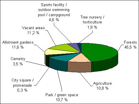
Fig. 4: Shares of the Various Use Categories of the Total Inventory of Green and Open Space of Berlin
Image: Umweltatlas Berlin
Environmental Atlas Contact
Berlin Senate Department for Urban Development, Building and Housing
Mr. Döllefeld