The classification process was carried out for the entire mosaic of the 2020 true orthophotos. Figure 6 presents a section of the result of the classification in the Großer Tiergarten area.
New
The Environmental Atlas maps are available in the new Map Application
Vegetation Heights 2020
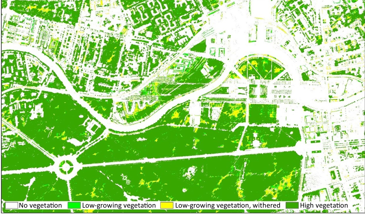
Fig. 6: Section of the result of the classification in the Großer Tiergarten area
Image: Umweltatlas Berlin
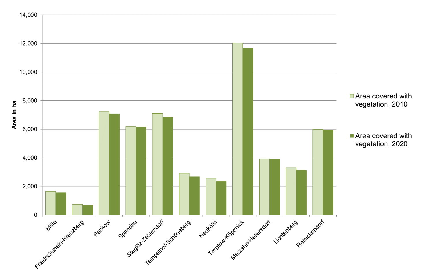
Fig. 7: Absolute sizes of areas covered with vegetation in the 12 boroughs of Berlin in 2010 and 2020
Image: Umweltatlas Berlin
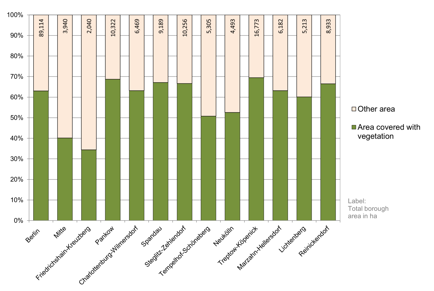
Fig. 8: Distribution (in percent) of the area covered with vegetation in the 12 boroughs of Berlin (as of August 2020)
Image: Umweltatlas Berlin
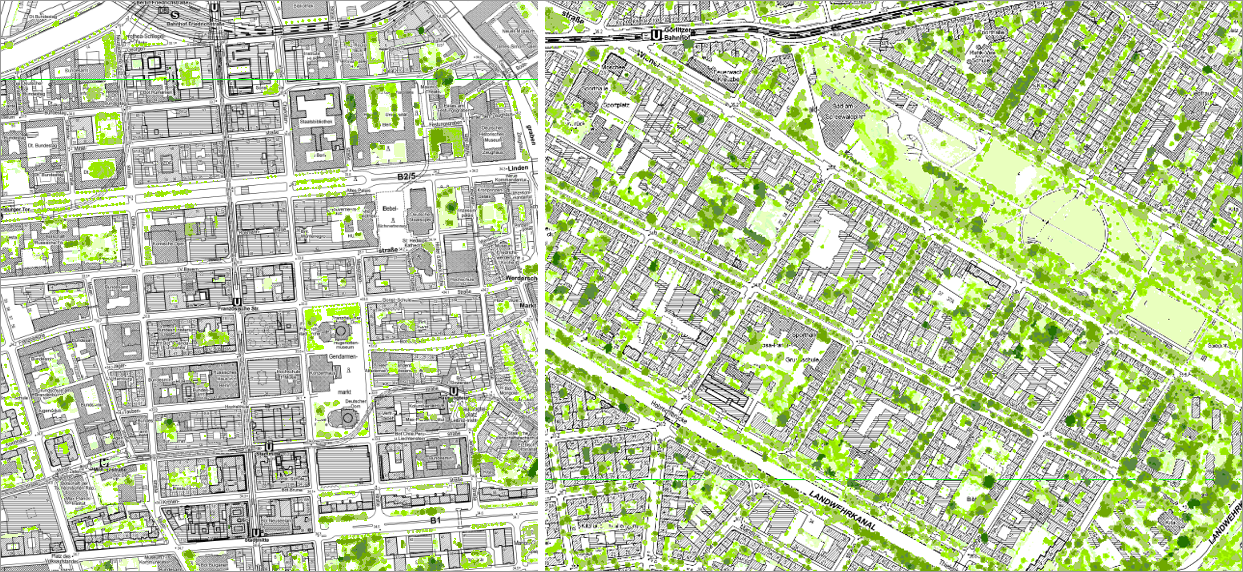
Fig. 9: Results of the classification in Berlin’s inner city: dense, highly impervious inner-city development on both sides of Friedrichstraße (left) and Wilhelminian block development with a high share of greenery in the area of Görlitzer Park (right)
Image: Umweltatlas Berlin

Fig. 10: Results of the classification in the area of loose, very green development on the edge of the inner city (inside the City Rail Circle Line): row houses and duplexes with yards in “Neu-Tempelhof” (left) and row development with landscaped residential greenery south of “An der Wuhlheide” in Treptow-Köpenick (right)
Image: Umweltatlas Berlin
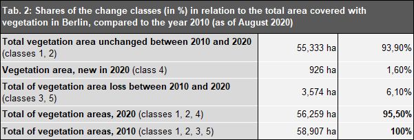
Tab. 2: Shares of the change classes (in %) in relation to the total area covered with vegetation in Berlin, compared to the year 2010 (as of August 2020)
Image: Umweltatlas Berlin
Class description:
- Class 1: Vegetation not recorded in the initial analysis of 2009/ 2010, still present in 2020,
- Class 2: Vegetation present in 2010 and 2020,
- Class 3: Vegetation present in 2010, no vegetation in 2020,
- Class 4: Vegetation recorded in 2020, no vegetation in 2010,
- Class 5: Vegetation not recorded in the initial analysis of 2009/ 2010, no vegetation in 2020.
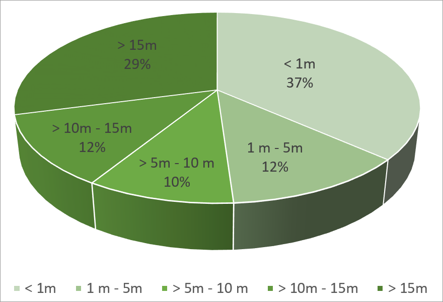
Fig. 11: Shares of vegetation heights of the total vegetation area in Berlin in 2020
Image: Umweltatlas Berlin

Fig. 12: Changes in the vegetation area shares (in %) of the block (segment) areas between 2010 and 2020
Image: Umweltatlas Berlin
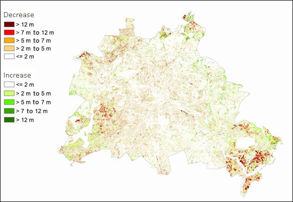
Fig. 13: Changes in vegetation height in metres at grid level (1*1 m²) between 2010 and 2020
Image: Umweltatlas Berlin
Environmental Atlas Contact
Berlin Senate Department for Urban Development, Building and Housing
Mr. Hartbecke