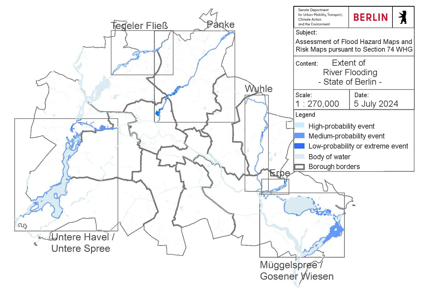
The Geoportal Berlin provides flood hazard maps for each scenario:
The flood risk maps display the potential flood damage for three flood scenarios with high, medium, and low probability. They provide information on:
- the number of inhabitants potentially affected in each risk area,
- the negative impact on economic activity and land use in the affected areas,
- the negative effects on UNESCO World Heritage Sites, and
- conservation districts that may be affected, e.g. drinking water protection zones and Natura 2000 sites.
The Geoportal Berlin also provides flood risk maps for each scenario:
The flood hazard maps and flood risk maps are key tools for flood prevention and protection. They provide information and visualisations of the potential flood-related dangers and risks and can be used as a basis for taking individual precautionary measures. They are also intended for use by authorities internally. These tools serve as the foundation for developing measures within the Flood Risk Management Plan.
The national flood hazard and flood risk map application (Nationale Hochwassergefahren- und Risikokarten, only available in German), developed by the German Federal Institute of Hydrology (BfG) (BfG 2019) acts as the national platform for flood hazard and risk maps across Germany, in accordance with the FRMD.
The flood area map of the State of Berlin shows the areas of officially established and provisionally secured flood areas in the city. The boundaries of the flood areas are marked by the outer edges of the hatched areas on the map. The water bodies themselves and their banks are not part of the flood areas. For the flood area of the Lower Havel/ Lower Spree and Müggelspree/ Gosener Wiesen, the contour lines showing water surface elevations are also displayed. In the case of the Lower Havel/ Lower Spree flood area, a distinction is made between Lower Havel I and Lower Havel II to standardise specific exceptions to land use restrictions based on
hydraulic conditions.
Upon designation, the regulations of the respective flood area ordinances (only available in German) apply. These ordinances complement and, in some cases, mitigate the provisions of the Federal Water Act (WHG):
The legal designation or provisional securing of the Wuhle flood area is currently in preparation.
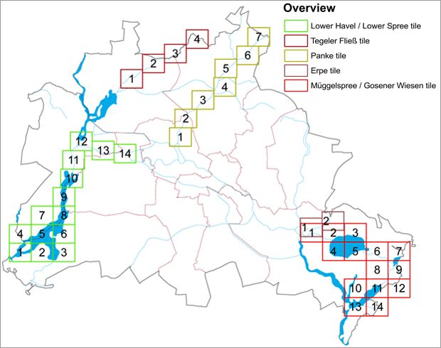
In flood areas, building restrictions apply, along with other limitations that must be considered in urban planning and land use. Outside of these flood areas, flood hazard maps define the spatial context for ‘risk areas’ (cf. Section 78b para. 1 sentence 1 WHG), which are also subject to restrictions, such as those related to domestic heating oil systems. Upon designation, the protective regulations of Section 78 of the WHG come into effect, including building restrictions, land use limitations, and water protection. The provisions of the individual legal ordinances that designate the flood areas add to these protective regulations and, in some cases, mitigate them. Each ordinance is accompanied by 2 to 14 maps, depending on the size of the area, that display the boundaries and regions covered by the designated flood areas at a scale of 1 : 2,500. Figure 3 provides an overview of the individual map sheets (or tiles).