The vertical extent of Berlin’s buildings is intertwined with the building history of the city, which includes the reconstruction measures after World War II. The descriptions for the Environmental Atlas maps “Urban Structure” (06.07) and “Urban Structure – Area Types Differentiated” provide detailed information on the settlement development of the city. Berlin gained more political and economic importance swiftly, especially after the founding of the German Empire in 1871. Settlement therefore developed just as rapidly throughout the various building eras.
The publication “Berliner Pläne 1862-1994” (Berlin plans, only in German, SenStadt 2002) provides another detailed account of Berlin’s building history.
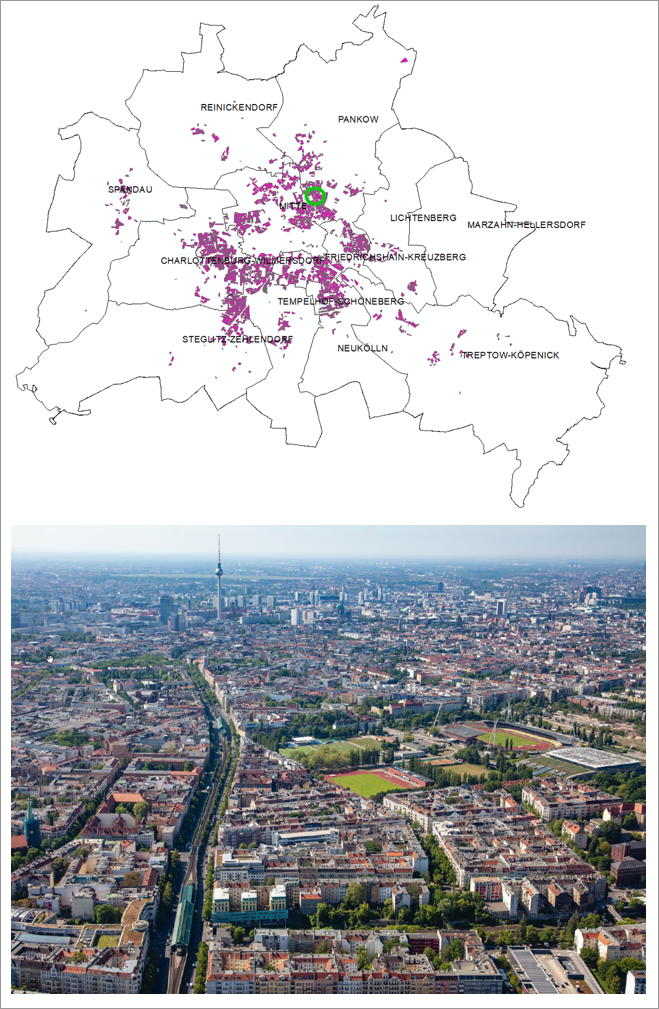
The typical Berlin block development dominated tenement housing, initially only within the area of the Circle Line, which opened in 1877, later well beyond it and in some areas it has up to the present day. From 1853, the ‘Baupolizeiordnung’ (building regulations) laid down the height of buildings for Berlin amongst other things. It set the Berlin eaves height at 22 m, which still applies today in general (the map shows the calculated height of the building’s roof ridge, however). Including the basement, this usually provides space for six to seven storeys in a building.
As a result of this regulation and the fact that the reconstruction after World War II also returned to the previous floor plans and height structures of existing buildings to a great extent, large parts of Berlin’s inner city, even today, display a relatively uniform roofscape.
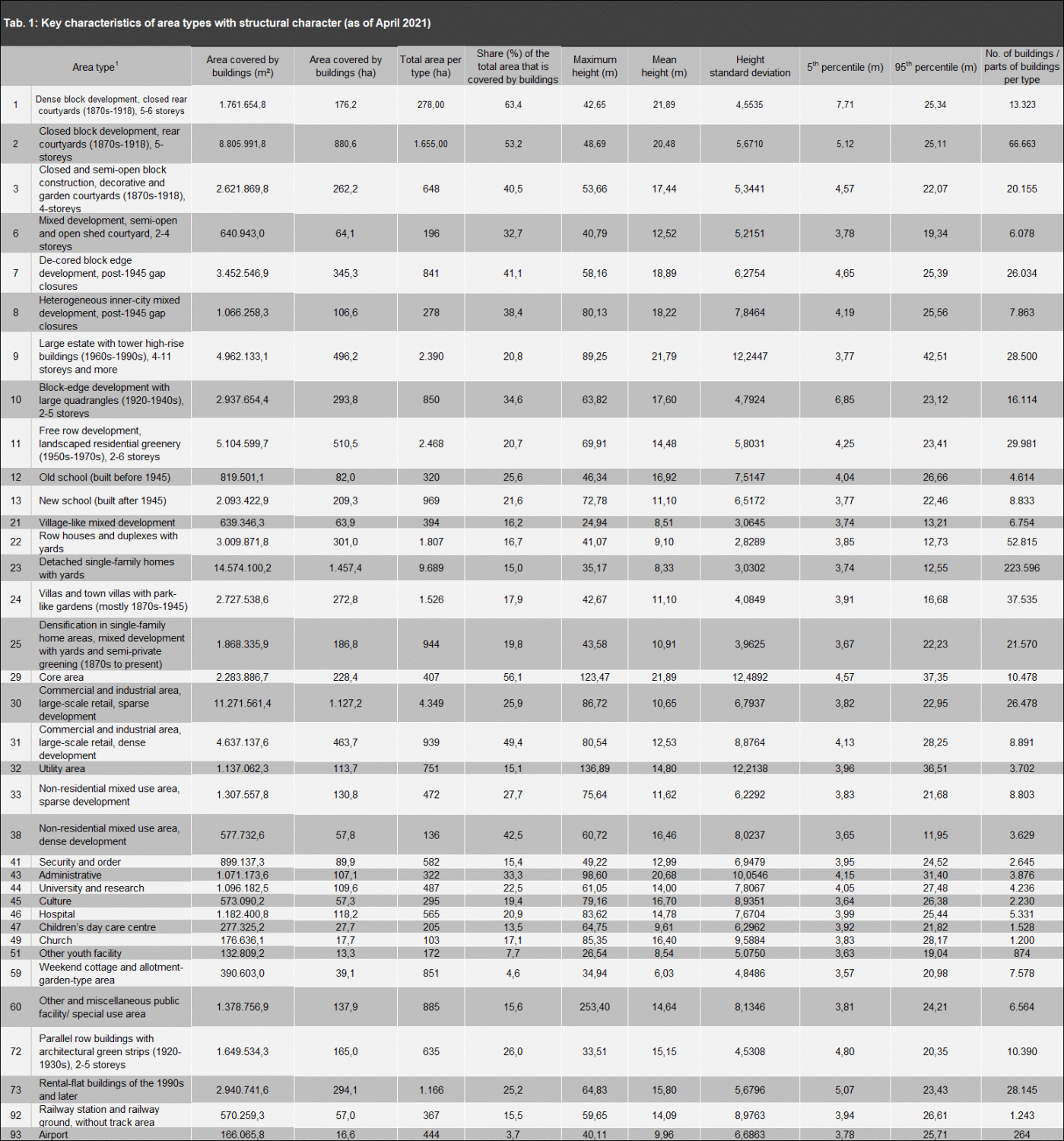
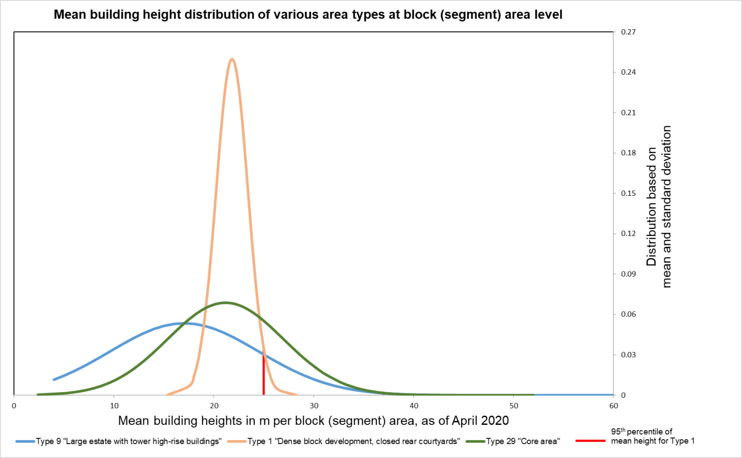
Approximately 3,400 ha, and thus about 10 % of the Urban and Environmental Information System’s (ISU) residential area types are part of the old building quarters in the inner city. They are directly affected by the eaves height restriction (cf. Map 06.08 “Urban Structure – Area Types Differentiated as well as Figure 4 and Table 1).