Groundwater Levels of the Main Aquifer and Panke Valley Aquifer 2006

Methodology

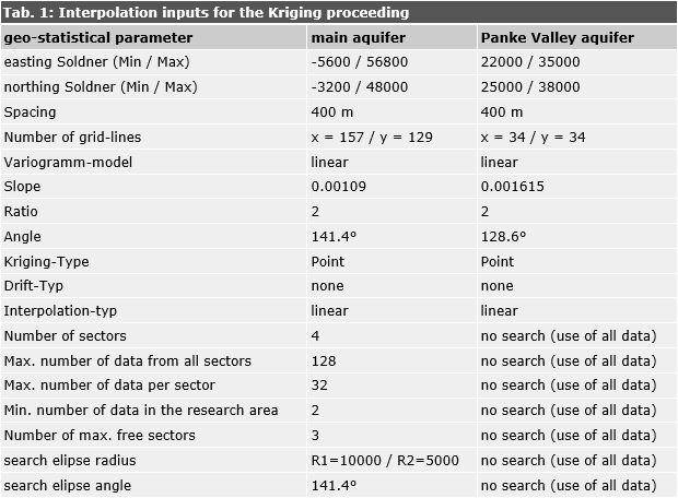
The groundwater isolines of the main aquifer as well as the Panke Valley aquifers were calculated using a interpolation method (point-Kriging). To get informations about the interrelation between the measuring points, concerning their spacial distribution and groundwater level, first data were analysed by Variogramm-analysis.

The geo-statistical parameter determined by the Variogramm-analysis for the main groundwater aquifer and the Panke Valley aquifer are listed in Table 1.

Tab. 1: Interpolation inputs for the Kriging method

Tab. 1: Interpolation inputs for the Kriging method

For the calculation of the groundwater isolines of the main aquifer, the irregularly distributed groundwater measurement data (base points) were transformed into an equidistant grid with the aid of a program for the calculation and graphic representation of surfaces (Surfers 8.0, by Golden Software). This was accomplished by interpolation according to the Kriging method. The groundwater isolines were represented on the basis of this grid, after smoothing.