
The basic data for the preparation of the groundwater isoline map are provided by the Working Group Geology and Groundwater Management of the Senate Department of Urban Development.
The regular recording of groundwater levels and their development started already in 1870 at 29 groundwater measurement points (Fig. 8).
New
The Environmental Atlas maps are available in the new Map Application
Groundwater Levels of the Main Aquifer and Panke Valley Aquifer 2006
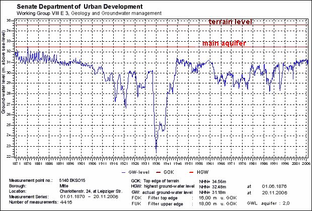
Fig. 8: Hydrographic Curve of Groundwater Levels at a Measurement Point in the Borough of Mitte, from 1870 to the Present
Image: Umweltatlas Berlin
Environmental Atlas Contact
Berlin Senate Department for Urban Development, Building and Housing
Mrs. Haag