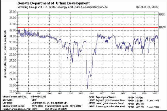
The Berlin groundwater measurement network grew rapidly: By 1937, measurements were already being taken at more than 2,000 measurement points. At present, following a measurement network optimization in the city area, the State Groundwater Service operates 1,140 measurement points which are screened into the five different aquifers. The measurement points are equipped with data loggers, and provide daily measurements. The Berlin Water Utility takes monthly measurements at 1,123 groundwater measurement points, predominantly in Berlin. For the most part, these are screened into the main aquifer (2nd GWL.)
The present map incorporates measurements from 1,508 groundwater measurement points, which are screened exclusively into the main aquifer (2nd GWL). At the measurement points which are measured daily, the value of May 31st 2002 was used; at the others, the monthly value for May 2002 was used.
The distribution of the measurement points is irregular: The measurement network is densest in the city center and in the immediate intake areas of the individual waterworks, and is thinner at the outskirts of the city.

