Berlin Wall Trail - From Staaken to Hennigsdorf

A map display follows. Skip map

MAP loading ...

End of map.

Link zeigt: Orte-Markierungen Former border crossings

Link zeigt: Orte-Markierungen Museums and exhibitions

Link zeigt: Orte-Markierungen Memorials

Link zeigt: Orte-Markierungen Artistic markers

Link zeigt: Orte-Markierungen Memorial sites for the victims of the Berlin Wall

Link zeigt: Orte-Markierungen Commemorative sites

Link zeigt: Orte-Markierungen Remains of the Wall

Link zeigt: Orte-Markierungen Historical information

Link zeigt: Orte-Markierungen Places of interest

Link zeigt: Orte-Markierungen Other key sites

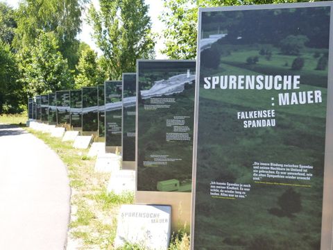
Exhibition: "Spurensuche: Mauer"

This tour along the northwest edge of Berlin starts at the Staaken regional train station. The GDR leadership had trains and passengers checked at this former frontier station for the northern transit route; customs dogs were also used in these inspections. Along the railway embankment, which until 1989 was cordoned off by two walls to keep the surrounding population out, you take Eichholzbahn to Finkenkruger Weg. North of Torweg you will see a Berlin Wall Trail info board. It tells about the church Franziskuskirche, which stood here on the border strip until the end of 1987, when the GDR government finally ordered it torn down. At the end of Finkenkruger Weg, where it intersects with Strasse 347, are a memorial cross for Willi Block and, since 2011, an info marker that tells about his life. After escaping from the GDR twice in 1962, and returning each time, Willi Block was arrested for alleged spying and sentenced to five years in prison in 1963. After being released early, he again tried to cross the border in Staaken to the west on 7 February 1966. He was discovered on the border strip by two border guards, who ordered him to come back – but because his clothing had gotten caught in barbed wire, he was unable to obey. A commanding officer of the 34th border regiment of the National People’s Army killed him with a volley from a submachine gun. In 1997, this commanding officer was sentenced to three years in prison for second-degree manslaughter.

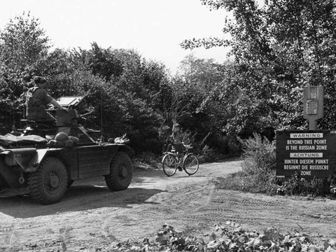
British armored reconnaissance vehicle guarding a child from the Eiskeller exclave on his way to school

The route through Spandau Forest brings you to the former West Berlin exclave Eiskeller. It owes its name (“icebox”) to the consistently low temperatures that made it a preferred storage area for ice cut from the lake Falkenhagener See. The exclave was connected to the Spandau borough by an access road that was only four meters wide and 800 meters long. Three families lived on farms in Eiskeller and, in the fall of 1961, the story of one 12-year-old from Eiskeller made the news far beyond Berlin. You can read all about it at the info board along the Wall Trail.

The Wall Trail in Eiskeller

A number of info markers along this path are dedicated to different victims of the Wall: Klaus Schulze and Helmut Kliem, Martin-Luther-Strasse (Falkenhöh); Adolf Philipp, between Eiskeller and Falkenhöh; Ulrich Steinbauer, Eiskeller; and Dietmar Schwietzer, Schönwalder Allee. There is also a memorial to “Den Opfern 1961–1989” (The victims from 1961 to 1989) on the corner of Berliner Allee and Schönwalder Allee. From Eiskeller you continue west, passing the memorial cross for Adolf Philipp at Oberjägerweg. On 15 May 1964, he left West Berlin and entered the border strip, where he was shot by GDR border guards. What he had in mind is still unknown.

Continuing west on the trail will bring you to the Havel River and to the weekend communities Fichtewiese and Erlengrund. They, too, were West Berlin exclaves on the territory of the GDR. Owners needed to cross through the border installations to reach their property, using an intercom at the gate near the recreational area Bürgerablage to announce their arrival to the GDR border guards. It was not until 1 July 1988 that an exchange of territory with the GDR restored free access to these weekend properties.
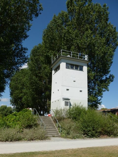
Watchtower

From the former exclaves, the route runs along the Havel into Hennigsdorf to the north. Older West Berliners associate this community with the “march of the steelworkers.” This protest march on the morning of 17 June 1953 was one of the few events experienced personally by West Berliners during the uprising in the GDR: workers from the steel mill in Hennigsdorf had marched through the West Berlin boroughs of Reinickendorf and Wedding, which gave them an enthusiastic welcome, to the House of Ministries (Haus der Ministerien) at the corner of Leipziger Strasse and Wilhelmstrasse to confront the GDR government with their social and political demands. In Nieder Neuendorf, a neighborhood in Hennigsdorf, you can still see a watchtower and the small museum it has housed since the tenth anniversary of the fall of the Wall.

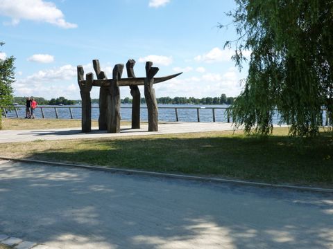
Sculpture ensemble "Von Ufer zu Ufer" (From shore to shore) at the lake Nieder Neuendorfer See

Crossing the bridge at the end of Uferpromenade will take you to the Oder-Havel-Kanal and the former Hennigsdorf border crossing, a waterway checkpoint. From 1949 to 1990, it lay on the lake Nieder Neuendorfer See between the lake, the Havel River, and the canal that was dug later. Ships used to transport goods to and from Poland or to the GDR were permitted to enter here, while transit traffic to West Germany and motorboats were not. After Berlin was divided into sectors and the outer borders of the GDR were closed, the GDR government had the Havelkanal built from 1951 to 1953 to enable ships to sail around West Berlin, since the Havel River runs through the western half of the city between Hennigsdorf and Potsdam.

On the western bank of the Oder-Havel-Kanal, info markers tell the story of what happened to Peter Kreitlow and Francisek Piesik. While attempting to escape, Peter Kreitlow was shot and killed by a Soviet patrol in the woods near Nieder Neuendorf on 24 January 1963. Francisek Piesik drowned in the lake Nieder Neuendorfer See on 17 October 1967 during his own escape attempt.

  • About the route: From the Staaken regional train station, you take Finkenkruger Weg north to the end of the road and then continue northeast across Falkenseer Chaussee, past the hospital Waldkrankenhaus, and into Spandau Forest. The main route takes you past Eiskeller, while the alternative route enables you to bypass the former exclaves in part. At Schönwalder Allee the Wall Trail turns to the west, leaving the former course of the border, and then returns to it before the lake Lasszinssee and follows it to Niederneuendorfer Allee. There the route swings to the south, meeting the Havel River at the Bürgerablage swimming beach. From there it continues north, where you can also connect with the Berlin – Copenhagen long-distance bike route. The documentation center in Nieder Neuendorf is open Tuesdays through Sundays from April to October. From there you follow Uferpromenade to Spandauer Allee. Once you have crossed the bridge, the trail takes you along Walter-Kleinow-Ring on the right to the bank of the Oder-Havel-Kanal. You then follow the canal to Hafenstrasse, which takes you west to the Hennigsdorf S-Bahn station. Cyclists who want to take public transportation along the way will not be able to shorten the 20-kilometer route from Staaken to Hennigsdorf. If you are on foot, you will be able to take the bus to Spandau or to various towns in Brandenburg at several different points along the route.

Sights along the route

Kleine Straße mit niedriger Wohnbebauung und Gehwegüberfahrt, Gartenstadt Staaken

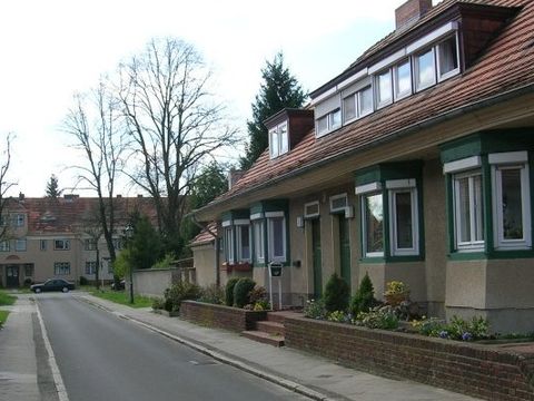
Gartenstadt (“garden city”) Staaken

The Ministry of the Interior of the old German Reich had the Staaken Gartenstadt (“garden city”) built for the employees of the armaments factory in Spandau from 1914 to 1917. Gartenstadt (“garden city”) Staaken

KZ-Außenlager Falkensee

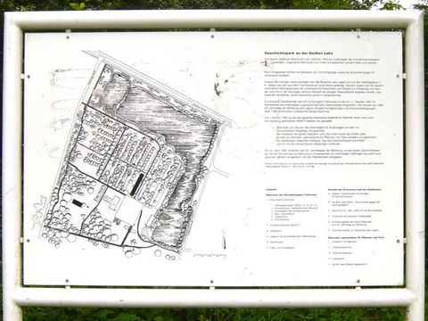
Falkensee satellite concentration camp memorial

The Sachsenhausen concentration camp maintained a satellite camp in Falkensee from 1943 to 1945, where 1,600 to 2,500 prisoners primarily from France, Poland, the Soviet Union, and Norway lived in nine brick barracks. Falkensee satellite concentration camp memorial